
'SOGGY BOTTOM'
Plans to build sport pitches in a floodplain actually do resemble a bad 'British Bakeoff' creation!
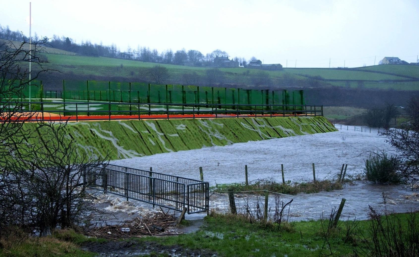
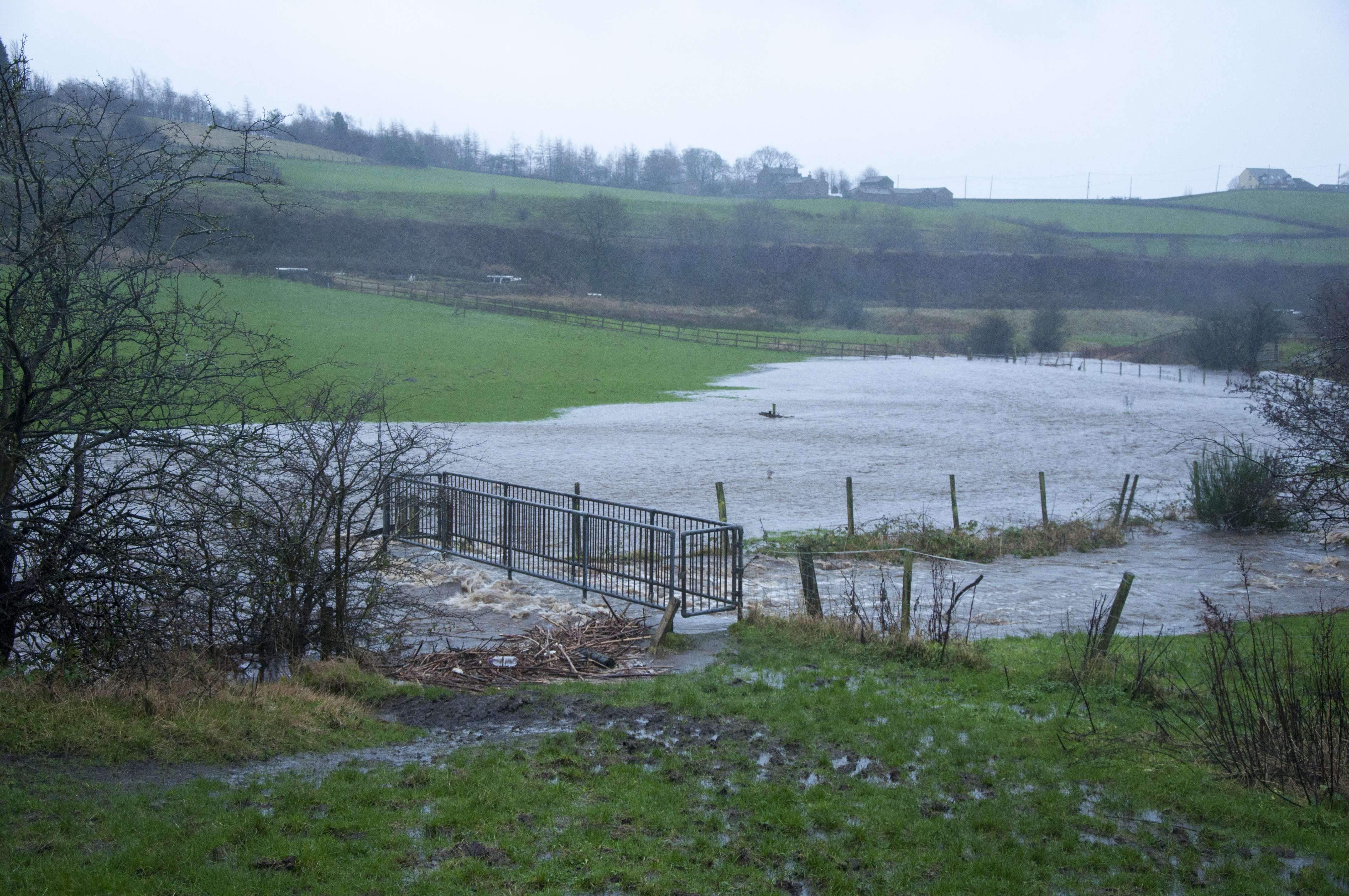
However, this is no laughing matter! In order to justify moving Saddleworth School from Uppermill to Diggle - Oldham Council & the Education and Skills Funding Agency need to be able to show that they can also replace the sport pitches that go with the school - if not then its another good reason NOT to move the school. Thus they have drawn up plans to try & force sport facilities onto a floodplain between the Main River & Huddersfield Canal. The field slopes steeply, so levels will need to be built-up in order to create a flat surface (and this will compromise the floodplain, remove floodplain storage - resulting in more flooding downstream and within the site).
It is clear that these plans are at best unsustainable (or more likely - unworkable). However, rather than consider the Uppermill site (and back out of the land-swap arrangement with WRT developments) Oldham Council & the ESFA have spent the last 5-6 years (2014 - 2019) trying to convince the Environment Agency & Sport England that these plans are actually possible!
Consultees
As stated above - Oldham Council & the ESFA have spent the last 5-6 years (2014 - 2019) trying to convince the Environment Agency & Sport England that these plans are actually workable! They've gone to extreme lengths to cover-up the truth and try & make these consultees drop objections:
- Sending 'bespoke' reports (with falsified plans) to Sport England.
- A council officer sending e-mails demanding that SE drop their objection on the day of the planning committee meeting in 2016.
- The Head of Planning failing to consult with the Environment Agency & obtain their comments on a new flood report (updated to rectify a 'mistake') the week before planning committee in 2016.
- The Head of Planning complaining to the parish council about the Environment Agency applying too much scrutiny to plans in 2018.
- The planning applicant producing a total of 6 flood reports - consistently failing to provide the necessary information to assess flood risk & consistently misrepresenting the development.
- Most recently - falsifying a flood model to make it look like there will be a limited impact on flooding.
- A planning officer report that gives false assurances about flood-risk to the proposed 'all-weather pitch' facility (which happens to be less than 5m from the edge of the main river bank).
This is what we know about - it may well be that other such underhanded communications have been applied from the top-down i.e from senior political 'representatives' to senior figures in the Environment Agency and Sport England.
The maps & plans below show why Oldham Council & the ESFA have had to work so hard to try & conceal the truth about flooding at Diggle. The Uppermill alternative site has a much lower probability flooding after rainfall & zero probability of being inundated with river flood water!
DIGGLE V UPPERMILL: the evidence below clearly show that Uppermill wins hand's down in terms of avoidance of the flood & erosion issues that the Diggle facilities would be subject to:
Diggle v Uppermill: Fluvial (river) flood extent
Diggle - flood extent

Uppermill - no river flooding at all

The Flood Extent shown is taken from the official Oldham SFRA river flood model:
1 in 25 yr. (dark blue) ; 1 in 100 (mid blue); 1 in 100 + climate change (light blue)
Diggle v Uppermill: Flood Zones for Planning
(Diggle = Floodzone 2 & 3: Uppermill = no Floodzone)
DIGGLE

UPPERMILL

Diggle v Uppermill: Flood depths
(River water flooding+ surface water flooding or 'hydrological interactions' in the worst case scenario)
Diggle

UPPERMILL
